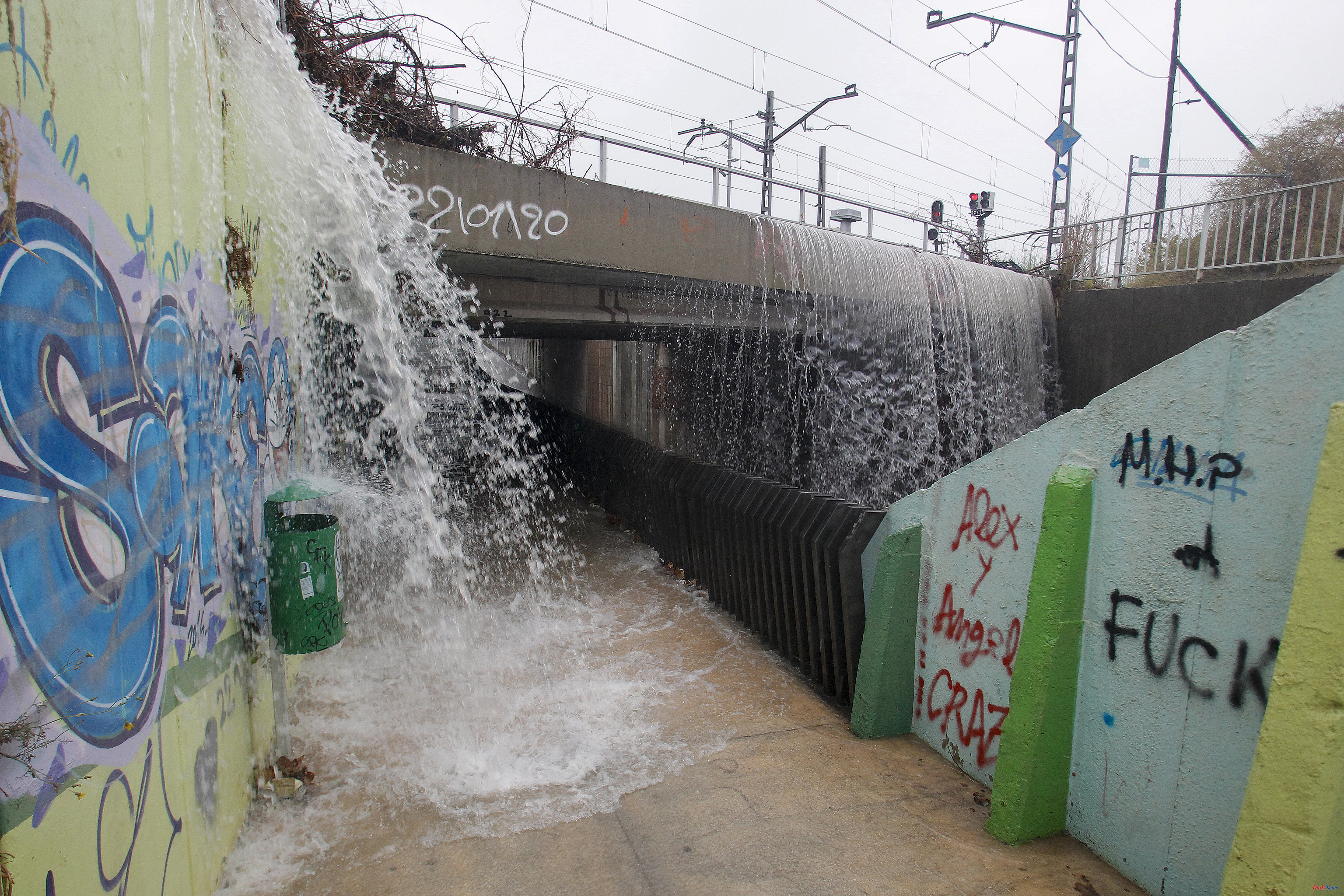
When many areas of the eastern peninsula are still recovering from the floods left by the storms, the presence of another DANA (isolated depression at high levels) coming from the interior of the European continent and moving towards the Atlantic has forced the State Agency of Meteorology (Aemet) to activate this Thursday warnings for heavy rains and storms in areas of seven autonomous communities in eastern Spain.
The Aemet prediction, collected by Servimedia, indicates that this Thursday it will rain especially in Catalonia and the provinces of Huesca, Castellón and Valencia, as they are the areas closest to the radius of action of the new DANA, which replaces the one that has hit above all the peninsular southeast since last Monday and has moved away across the Mediterranean.
However, there is a yellow warning -risk for outdoor activities- due to storms and heavy rains of 20 to 30 liters per square meter in Barcelona, Castellón, Girona, Huesca, Lleida and Valencia as a whole.
The same occurs with areas of Albacete (Hellín and Almansa), Alicante (inland), Granada (Guadix and Baza), Jaén (Carzorla and Segura), Murcia (Altiplano and northwest), Tarragona (except for the central depression), Teruel (Albarracín , Jiloca, Gúdar and Maestrazgo), as well as the islands of Mallorca (inland and south), Ibiza and Formentera.
Due to an extensive drop in height, instability will persist in the peninsula and the Balearic Islands, with cloudy skies and daytime cloudiness during the afternoon. Showers and storms are likely in large areas of the interior south, center and, locally strong, the eastern third of the peninsula and the Balearic Islands.
In the eastern half of the Cantabrian Sea, the situation can become unstable at the last minute with showers that cannot be ruled out as being locally moderate.
The weather will be more stable in the extreme northwest, as precipitation is not expected in the south of Galicia, where the skies will be slightly cloudy, with some cloudy intervals of diurnal evolution. The Canary Islands will have skies with cloudy intervals, evolutionary cloudiness and some isolated showers in the afternoon in the interior of higher relief islands.
The temperatures will be normal for the time of year, with ascents in the southern half and decreases in Catalonia, eastern Castilla y León, Navarra, La Rioja, the northern half of Aragon and Castellón.
The hottest capitals could be Badajoz (31 degrees), Córdoba (29) and Cáceres and Zamora (28), while it will soften more in Barcelona, Burgos and Soria (19).
Finally, this Thursday winds will blow from the north in the northern half of the peninsula, with strong intervals on the northwest coast of Galicia, from the east in the Mediterranean area, and from the north and breezes in the Canary Islands.
According to the criteria of The Trust Project