Winter is coming back: after a brief high in temperatures, cold and snow hit Germany again, first in the Alps, and later perhaps in the lowlands as well. Winter tourists will be happy, but ntv weather expert Björn Alexander warns of avalanches.
ntv: How is the weather situation developing?
Björn Alexander: Before the low "Pit" and low "Qendrim" reach us again with a sometimes strong to stormy wind and sometimes heavy precipitation, high "Cäcilie" ensures a generally more peaceful outlook - at least for a short time.
What happens afterwards?
Behind it, the warm front from "Pit" ensures longer-lasting rain, which turns into snow in the Alps above around 1000 meters. And even then it builds up in the high mountains. At the same time, the snow line is falling. By the weekend at the latest, the cold fronts with arctic cold air will be rattling again as far as southern Germany and the Alps. Even a prolonged winter episode in Germany well into next week cannot be ruled out.
What details await us in the coming days?
A look at the weather computer and the amount of precipitation reveals an inconsistent picture. But the fact is: From a snow line of around 600 meters, the solid precipitation initially rises to around 1000 meters before arctic cold air moves up on Sunday and lets the flakes trickle down to the flat land again. Before that, it was snowing on the mountains in the Alps.
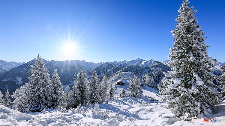
Where is it snowing the hardest?
This applies above all to the storage areas on the north side of the Alps from Voralberg in Austria via the German edge of the Alps in the Allgäu or in the Berchtesgadener Land and further via Tyrol to Salzburg (Salzburger Land). The Bavarian Forest and Upper Austria will certainly get some fresh snow - but overall they are not quite as exposed or intense.
How much snow can be expected?
At the moment we have to assume that there will be one to two meters of fresh snow at high altitudes above 1000 meters. In exposed areas, even more than two meters of snow cannot be ruled out up to and including Monday. In addition, a brisk to stormy wind is blowing, which can sometimes lead to considerable transport and drifting.
What does that mean?
An extremely dangerous development in terms of avalanche danger. High winter road conditions with corresponding impairments also threaten in the higher regions. Winter tires are popular in one way or another - and in some cases advanced winter equipment such as snow chains. And the German low mountain ranges from the Eifel and Sauerland to the Ore Mountains and in the direction of the Black Forest and Alb are likely to experience wintry road conditions again with the corresponding slippery surface at the weekend with the falling snow line.