The north-westerly air current continues to push the clouds against the mountains. This will also bring a lot of snow or rain in the coming days. After a comparatively quiet weekend, things are getting rougher again, as ntv meteorologist Björn Alexander explains. Temperatures will then increasingly fall into the frost range from the east.
ntv: How is our weather going now?
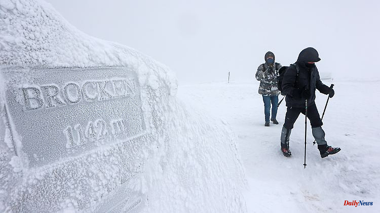
Björn Alexander: Recently, it has snowed and stormed heavily on the mountains. With corresponding disabilities, for example in the direction of the Harz Mountains, the Ore Mountains or the Alps. Currently, the warm front from the Atlantic low "Pit" is temporarily involved. On the one hand with relatively mild air and an increasing snow line up to around 1000 meters. On the other hand, heavy continuous rain falls in the lower altitudes - especially in the congested areas of the low mountain ranges.
How much rain can the affected regions expect?
In the brisk to strong northwesterly current, the clouds are squeezed out of the mountains by the storm. Interspersed with wet snow in the higher elevations. Above 1000 meters it snows consistently, below it there is a lot of rain. First of all with 20 to 40 liters per square meter or more. That's decent considering that the whole of February usually brings in around 55 liters on average across the country.
Is there a risk of flooding?
Fortunately, we don't have to worry about major flooding. Because there is still plenty of room in the streams and larger rivers - especially since the water balance and Mother Nature can also need plenty of rain before the thirsty spring.
But the danger of storms remains, doesn't it?
First of all, it is still very stormy, especially in southern Bavaria in the mountains of the Alps - with snowfall and drifts and a correspondingly increasing avalanche danger, which will also reach the highest warning level 5 of 5 in the coming days. Otherwise there is a temporary slacking wind before it gets rougher again from the north-west.
What does that mean in detail?
On Friday it will continue to be stormy during the day, with strong to stormy gusts and gusts of wind in the south-east, north and east. Heavy gusts of wind with wind speeds of up to around 100 kilometers per hour are preferred in the direction of the Baltic Sea and on the mountains. In places significantly more with gusts in the hurricane range.
And on the weekend?
First of all, a calmer start awaits us. But the calm doesn't last too long. The next low with stormy gusts is already rattling on Sunday. In parallel with the cold front, air of arctic origin is shifting from north-west to south-east. This causes the snow line to drop down to the lowlands and brings renewed adversity on the wind front.
What are the forecasts for Sunday?
Heavy gusts of wind threaten again on the coast – the risk of storm surges also remains. And on the mountains, further snowdrifts and sometimes winter road conditions can be expected.
Where is the weather pendulum swinging next week?
It is likely to get colder from the east. Exactly how cold is still uncertain. This means that we can expect widely frosty values at night, and moderate or severe frost is even possible over snow and under clearing conditions. During the day in the mountains and in general in the south-east permafrost knocks on the door with sometimes no more than minus 3 degrees, while in the north-west it should still be 5 or 6 degrees.
What is the wind doing?
It's likely to get weaker. The precipitation will also subside for the time being, giving the sun a few chances. All in all, it looks like calm winter weather - albeit with enormous uncertainties for further development.
Why is that?
In the past few weeks, the weather computers have repeatedly shown a so-called major warming in the forecasts. This is warming in the upper atmosphere that can affect the stability of the polar vortex. These processes can in turn have a significant impact on the course of winter in Europe and Germany. However, it is generally problematic for the weather models to evaluate and predict this correctly.
How big are the differences?
If we look at the model runs of the last few days, then we are between a mid-winter ice and frost phase and clear plus degrees for the second half of the coming week. At the same time, it is also a decisive step in the transition from winter to spring.
Why?
Because a polar high can establish itself in the unstable to amorphous polar vortex. On its flank, sustained cold air advances from east to north-east would then be conceivable. And that even into March, as the March winter of 2013 showed us with a negative monthly deviation of more than three degrees. All in all, the winter of 2022/23 is probably taking its last major step and we can be curious to see in which direction the weather models will develop and agree in the coming days.


