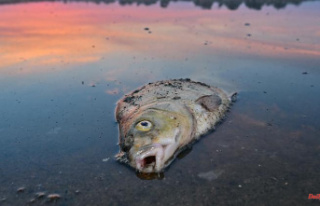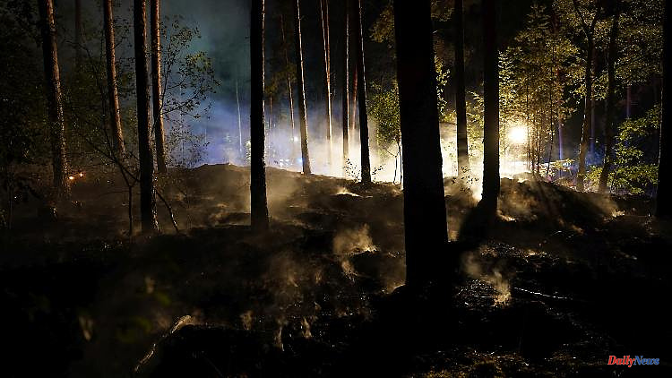
Using satellites, researchers can determine the number and severity of forest fires across Europe. In Germany alone there have been 45 major fires since July. Brussels assumes that 700,000 hectares of forest have been destroyed across the EU - and the summer is not over yet.
According to the latest data, there have been 45 major fires in Germany since the beginning of July alone. Several thousand hectares of forest, bush and pasture land have been destroyed, reports the German Aerospace Center (DLR). The experts use data from the Center for Satellite-Based Crisis Information (ZKI), which is operated by DLR and which publishes a map that is freely accessible online with the respective fires in Europe.
The map is based, among other things, on satellite data that shows the extent of the forest fires in Europe in new detail. "We can not only say where it burned, but also how much the vegetation was affected. This is important, among other things, for estimating the emissions produced," said group leader Torsten Riedlinger from the German Remote Sensing Data Center (DFD) in Oberpfaffenhofen, which also belongs to DLR.
For example, for a particularly large fire south of the French city of Bordeaux, the satellites recognized a burned area of almost 8,100 hectares - and also registered the loss of substance. "It was a particularly serious fire that destroyed dense forest. We can determine this using a special index that shows the burned biomass," said Riedlinger.
In Germany, too, the fire brigades are fighting against forest fires, which are favored by the extreme drought. According to the DLR report, the fires raged worst in Brandenburg near Falkenberg, where it burned on 780 hectares, and in Saxon Switzerland in the border region with the Czech Republic. Cross-border, 1160 hectares were affected there.
The data on the fires come from the two Sentinel-3 satellites, which are part of the European Copernicus program and cross Europe every day in their orbits at an altitude of about 800 kilometers. The Sentinel-3 satellites record the earth's surface with a ground resolution of around 300 meters via their optical systems.
Around 700,000 hectares of forest have already burned across the EU this year - almost twice the area of Mallorca. This is the highest value at this time of year since joint data collection in 2006, the EU Commission announced. "We are far from finished," said a spokesman for the Brussels authority, referring to the forest fire season. So far, the EU civil protection mechanism has been activated nine times by five countries in response to the fire.
In the past two months, 29 planes and 8 helicopters have been deployed across Europe via the EU mechanism to respond to the requests for assistance. They would be supported on the ground by 369 firefighters and more than 100 vehicles. The procedure allows a country to request help when it is overwhelmed with an emergency. The EU Commission then coordinates the support and covers most of the transport and the lion's share of the costs.
In addition, around 150 firefighters from Bulgaria, Romania, Germany, France, Finland and Norway were sent to Greece in July and August to support the local fire brigades, according to a statement from the EU Commission.