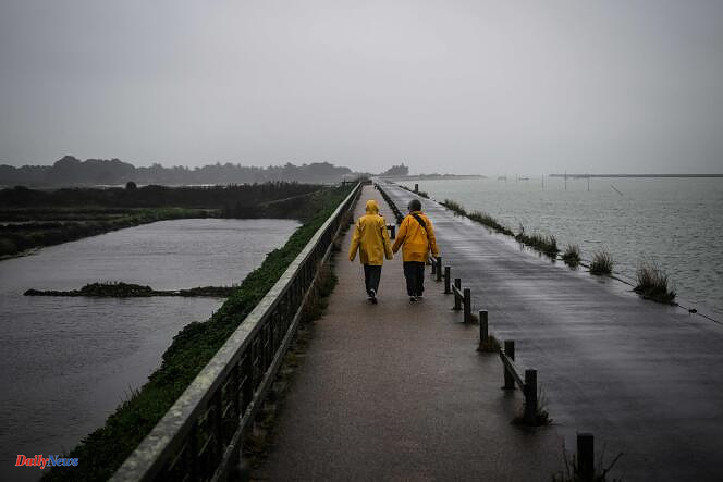
Météo-France has placed twenty-six departments on orange alert for Thursday February 22 due to depression Louis, most of them due to violent winds. Twenty-four departments of Île-de-France, Normandy, Hauts-de-France, Eure-et-Loir, Grand Est, as well as New Aquitaine and Occitanie are affected by this alert, according to the organization's 6 o'clock bulletin.
Orange rain-flood vigilance will also concern Deux-Sèvres and Vendée. This turbulent weather, mixing wind and rain, will be accompanied by a return of snow to the mountains.
In the morning, gray and rainy weather will affect the entire northern half of the country, as well as the Alpine arc, where it will snow from 1,600 meters. The southwest wind will be present, with gusts of 70 to 80 kilometers per hour, 60 to 70 kilometers per hour in the Northeast.
Depression Louis will deepen and generate violent winds from the beginning of the afternoon until the end of the evening in the departments placed in orange. They will be swept away by a period of heavier rain, associated with violent gusts of up to 90 to 110 kilometers per hour, or even 120 kilometers per hour near the coast. In Deux-Sèvres and Vendée, we also expect accumulations of up to 30 to 50 millimeters, or even 60 millimeters locally.
Unstable weather alternating between clearings, sleet and even sleet
This rainy and windy passage will extend over regions from the North-East to the South-West, with gusts of up to 70 to 90 kilometers per hour, and even peaks at 100 kilometers per hour in the evening near the Pyrenees. At the rear, it will be unstable weather alternating clearings, sleet and even sleet, with gusts of 90 to 110 kilometers per hour on the Atlantic coast and the English Channel, and 80 to 90 kilometers per hour inland. lands.
In the evening, the tramontana will accelerate to reach 90 to 100 kilometers per hour at peak, while the wind will drop a notch on the Atlantic coast and the English Channel.
Temperatures will also drop, with a rain-snow line dropping to between 800 and 1,000 meters in the evening and overnight, and heavy snowfall in the Alps.
Disrupted traffic and suspension of trains
Violent wind orange vigilance is pushing the SNCF to suspend the circulation of certain trains. These traffic suspensions, intended to “guarantee the safety of all”, concern TER lines in Hauts-de-France (Béthune - Saint-Pol-sur-Ternoise; Arras - Saint-Pol-sur-Ternoise; Beauvais-Abancourt- Le Tréport; Amiens-Compiègne; Creil-Beauvais and Paris-Laon), informs the SNCF on its website.
“The resumption of traffic on these lines will be effective Friday during the morning,” she said. “Disruptions” are also expected on Thursday in Brittany on the Quimper-Brest and Saint Brieuc-Lannion lines due to the risk of “strong winds”.