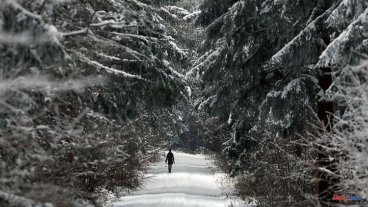
In the new weather week, snow is one of the dominant themes. Up to one meter of fresh snow can fall in exposed locations. Elsewhere it will remain rainy due to the predominantly mild temperatures above zero. In addition, storm depression "Nicolas" ensures a good wind.
After a quiet Sunday, the weather roulette turns up noticeably in the new week. In the tow of the Scandinavian depression "Michael" follows storm depression "Nicolas", which is also moving towards Scandinavia with its core. Accordingly, we only feel the foothills of the storm field. Nevertheless, a rather turbulent start to the week awaits us. And that's not all. At the same time, deep "Oleg" is forming from the Atlantic.
Accordingly, Monday and Wednesday in particular will be stormy with an increased risk of storm surges on the North Sea and, as a result, with sometimes heavy snowfalls in the direction of the Alps. Especially on Wednesday and Thursday, before a high could possibly make our weather strong.
Until then, the weather computers have a lot of snow masses in their forecasts - although the sums in detail are still evaluated quite differently. In the Black Forest there are 20 to 50 centimetres, in the Alps above 1000 meters there is a fairly common 30 to 80 centimetres. In the congested areas, there should even be amounts of fresh snow of around one meter. And even significantly larger amounts cannot be ruled out - depending on the weather model.
According to some models, significantly more than one meter of fresh snow could be expected, especially in the Allgäu and Arlberg area as well as in the Berchtesgadener Land. If this amount of snow should actually come like this, then the avalanche danger in the Bavarian Alps, in Vorarlberg, Tyrol and Salzburg should rise to at least the second highest level 4 out of 5.
A very dangerous climb, the end of which is unfortunately not yet entirely foreseeable due to the inaccuracies in the calculations for the weekend. In principle, there are currently two scenarios for the first weekend in February that balance each other out.
On the one hand the high-pressure variant with sun; on the other hand more showers, which preferably turn into snow in the mountains. But even a winter version with snow all the way down is still in the running. An exciting and very eventful weather week - here are the details.
Monday: "Nicolas" sends storm and hurricane gusts
With strong to stormy winds, showers will pass. In the middle, snow is possible at first, later rain with black ice. In the north there may be local lightning and thunder. In the south, meanwhile, it will remain friendly until noon and only in the afternoon will there be snow showers, which will turn into rain at low altitudes. At the beginning there is also a risk of black ice. With the wind, it will also be milder in the south with maximum values of 1 to 4 degrees, in the north and west 5 to 9 degrees. The wind peaks: on the coast and on the Fichtelberg heavy gusts of wind with wind speeds of up to around 100 kilometers per hour, on the Brocken in the Upper Harz hurricane gusts of around 120 km/h threaten.
Tuesday: April weather with sunny weather in the southwest
It is still very windy, stormy in the mountains and on the North Sea with showers that turn into snow above 600 to 800 meters. Only in the south and southwest is it nicer and often dry. In addition 2 to 7, from the North Sea to the Rhineland 7 to 9 degrees.
Wednesday: Storm danger increases again
Similar to Monday, it will also storm on Wednesday. In other words: heavy storm gusts are to be expected, especially on the mountains and by the sea, and hurricane gusts on the peaks of the low mountain ranges. And the weather is also pretty mixed: Local sleet and a snow line that has dropped to around 500 meters again. Because it is getting colder with 3 to 8 degrees, in the mountains by 1 degree.
Thursday: Snow clamp and danger of avalanches
While there is a mix of sun and clouds with showers in the lowlands, Mother Holle is piling up heavy traffic jams in the mountains: frequently in the Ore Mountains, with prolonged snowfall in the Alps. Depending on the model, 20 to 50 centimeters of fresh snow are possible within 24 hours. With a corresponding increase in the risk of avalanches and high winter road conditions. The temperatures: in Saxony and Bavaria 0 to 3 degrees, otherwise 4 to 8 degrees. But at least the wind is gradually easing.
Friday and weekend: Uncertain development
It's definitely too early for details. Especially since even the rough direction of travel still has a number of uncertainties. More snow showers are very likely to be expected in the mountains, which can be very heavy, especially on Friday. All in all, it should be dry more often at the weekend. In addition, there is little change in the temperatures. Friday highs from 0 to 8 degrees, at the weekend 1 to 9 degrees with the zero degree limit at 700 to 800 meters altitude. At night, however, it is increasingly frosty cold even in the lower elevations.