The new weather week begins stormy, but mild: In parts of Germany, temperatures climb to almost 20 degrees. However, late winter is back for the weekend. It's getting colder and sometimes rainy.
First of all, it is very mild and sometimes again very windy to stormy. In terms of early spring, this will remain the case up to and including Thursday, before the weather computers play with the idea of starting winter again.
There is now relative agreement that the second half of the week will be cold and wet, perhaps even wintry. At least the sustained awakening of spring, which has repeatedly gone through the calculations of the weather models in the last few days, is off the table for almost all trends. Instead, the wind will initially turn to the north from Friday and will very likely continue to turn to the east on Sunday - with the corresponding options for light permafrost in the mountains and mostly single-digit temperatures in the lowlands.
Even the beginnings of snowflakes, including white surprises, down to lower altitudes are possible - depending on the weather model. In this respect, there is still no boredom with our weather.
Another focus is on precipitation in the new week over parts of southern Europe. Here some calculations have rain totals of over 300 liters of rain per square meter in the running. The selective storm centers are distributed from Spain via the south of France to the central Mediterranean. Northern Italy, which was repeatedly hit by severe drought last year, could also get significant amounts of rain, so that there could at least be some relief from the drought. So the motto here is: keep your fingers crossed, while in this country the celebrations are sometimes vigorous with the carnival. And with these prospects.
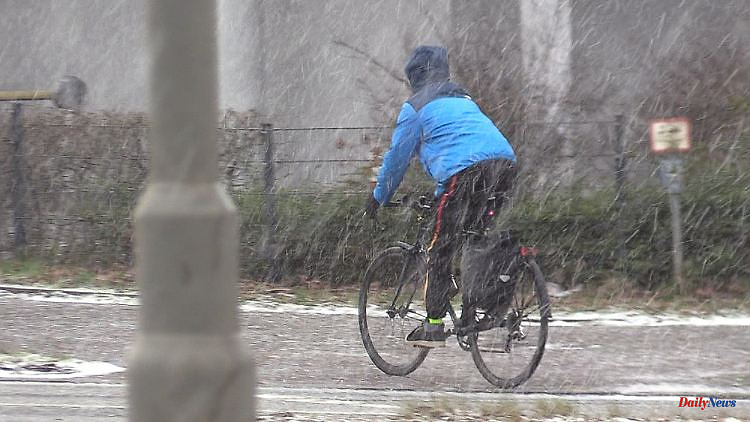
Monday night: risk of storms in the north
Especially in the north it will remain windy to stormy and partly wet. Even colder air is knocking on the door temporarily here, so that wet snowflakes can mix in, especially in the north-east. Otherwise it is often dry, and especially between the Eifel, Baden-Württemberg and later towards the Alps it stays clear for longer. It cools down to 6 to 0 degrees.
Monday: Two-part prospects
The situation will remain rough in the north and east, with brisk winds and more clouds. Especially with the Northern Lights there will be some rain or drizzle. Quite different in the south and in the carnival strongholds in the west. Because Petrus must secretly have a heart for the carnivalists who can celebrate Shrove Monday with the help of "Cornelia". The whole thing in the southwest half at super mild 11 to 15 degrees. In the windy and stormy north-east, on the other hand, there are hardly more than 8 to 11 degrees.
Tuesday: High point of early spring
With brisk wind, clouds and a meager 8 degrees, the prospects in the north-east are still rather bleak, i.e. uncomfortable to wet and cool. The situation is still different in the south and west, where the sun is more dominant away from the fog and the temperatures are pushing the 20-degree mark. It will almost certainly be 18 degrees, maybe even more.
Wednesday: Sunny parts will be less
Outside of the sometimes very dense fog and high fog, the sun can still assert itself quite well in the south. All in all, however, it is becoming more and more overcast, so that it is also becoming cloudier away from the permanently changeable north. After all: The wind, which has been stormy at times, will finally ease up on Wednesday. In addition, the temperatures reach 8 to 15 degrees.
Thursday: Showers will spread
The weather computers don't see too much rain coming. Nevertheless, the showers in the south and the middle are also more intrusive. In the higher mountains, a few snowflakes are also mixed in. Because the temperatures remain in reverse gear and have a maximum of 5 degrees in the Eifel and up to 12 degrees in the east in the program.
Friday and weekends: wet and cold to late wintry
Even if the details for the end of the week are still unclear: It is pretty certain that it will get colder and that the wind will turn from north to east. In the lowlands, temperatures are therefore more and more in the single digits, and in the mountains, permafrost is knocking on the door. Only in the west are there still peaks of around 10 degrees in the race at the weekend.
At the same time, cold air of polar origin will most likely spread to the south on Friday, so that the snow line will continue to drop with a few showers. How far is still uncertain. But the fact is: It's getting much colder. And that also applies at the weekend, when we have to adjust to frost or ground frost again, which is more common. After all, the sun should prevail regionally really well during the day. Depending on the weather model, 5 to 9 sunny operating hours would be possible.