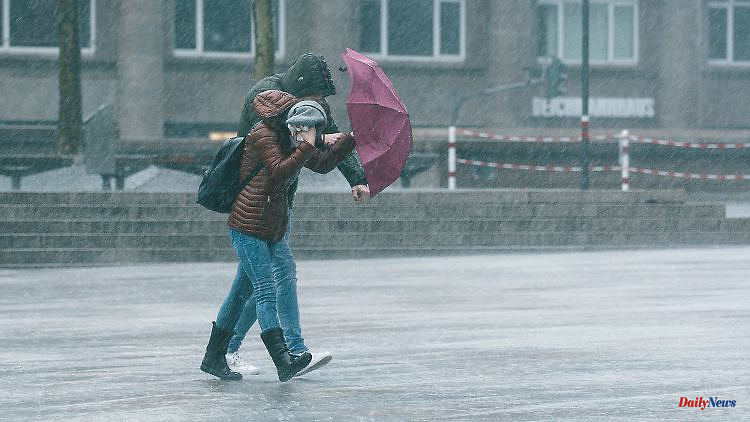
March remains uncomfortable, spring is not yet in sight. Instead, the cold, damp polar air also brings sleet and ice to the lowlands. In the middle of the week, a low storm hit large parts of Germany.
Spring and sun worshipers need to be strong in the new weather week. Because cold and wet polar air is finding its way into Germany. At the same time, more intense low-pressure areas are involved and allow the wind to freshen up from strong to stormy. A mixed situation that can sometimes be accompanied by snowdrifts, especially in the mountains. And even in the lowlands, the snow showers can ensure regional ice - especially since Father Frost still wants to play along with the danger of freezing wetness or frost at night.
In the course of the coming days in the mountains, amounts of fresh snow of 15 to 25 centimeters or more are conceivable. In the lower altitudes, the weather computers continue to rate the amounts of snow very differently. However, white surprises cannot be ruled out. The development of the late winter comeback also depends on what is happening in the southwest of our continent. Mild to warm air forms over the Iberian Peninsula to France, fighting the polar air advance over Germany on the front side.
The result is a so-called air mass limit that develops above us and that brings with it the more intense snowfall on the cold side. On the milder side, however, there will be plenty of rain. A scenario that will probably keep us busy until the end of the week, before more spring-like scenarios for our weather become more likely in the second half of the month. For the time being, patience, weatherproof clothing and, if necessary, winter tires are required. Here are the prospects in detail:
Monday night: Frost and snow showers
The temperatures are going down to minus 6 to 0 degrees and we have to expect ice with that. On the one hand through freezing wetness when the streets should still be wet. On the other hand, by further snow showers, which are particularly focused on the broad center of the country. Longer loosening is most likely to be expected in the north-east and in the Alps.
Monday: sun winner in the north-east
The Baltic Sea environment is still benefiting from cloud gaps and dry prospects at the start of the week. In the south, the risk of precipitation is also low. Meanwhile, the rest of the country will often be cloudy with intermittent sleet or snow that may be heavier in the middle. In addition, it is wet and cold with 0 to 7 degrees.
Tuesday and Wednesday: air mass limit and risk of storms
After the contemplative hustle and bustle at the beginning of the week, the weather conditions pick up several spikes. A low is approaching from the North Sea on Tuesday and is causing the wind to freshen up lively, especially in the northern half - depending on the weather model, wind peaks are around or even over 100 km/h.
At the same time, the air mass limit over the broad center of the country is tightening, so that it can snow more heavily in the mountains. Winter thunderstorms and blowing snow cannot be ruled out either. It is not yet entirely clear how far down it can become permanently white. The white winter aftermath is relatively safe above about 300 to 400 meters. But a lot is also possible below that. Only in the very south is it still friendly and dry for longer. The whole thing with daily highs between minus 1 and plus 9 degrees.
Thursday: Mild air reaches north
The air mass boundary is likely to expand a bit further north. Heavy rain with the possibility of thunder and lightning will set in in the south, while it can snow heavily further north. An intense weather situation, which is also likely to be accompanied by thaw in the southern low mountain ranges. The temperatures in the east sometimes only reach around 0 degrees, on the other hand up to 10 degrees in the Upper Rhine.
Friday and weekend: Extreme uncertainties with the risk of storms
Depending on which of the computer models is correct, it could be a rough weekend with brisk to blustery winds. In addition, most of the calculations would like to see the changeable to wet weather character. But analogous to wind and storm, the interplay between cold and milder air is still fairly unclear - with a wide range from the precipitation department. From heavy rain to freezing rain or freezing rain to options on snow, everything is actually in the big weather lottery. The weather kitchen only owes us the spring awakening - but that's definitely being worked on in the second half of the month.


